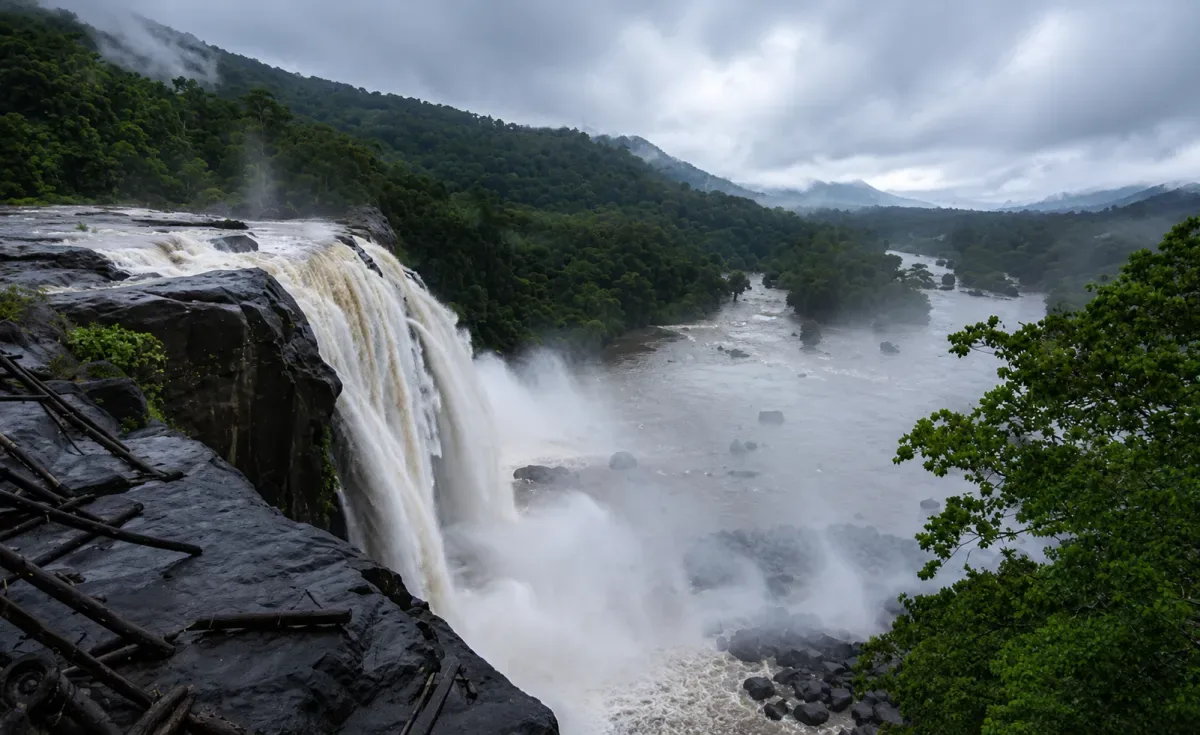
Athirappilly Falls and the Chalakudy River surrounded by misty forest

Thrissur · Kerala destination

Athirappilly

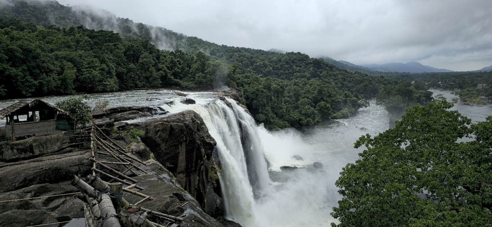
Athirappilly is Kerala’s largest and most famous waterfall, dropping about 80 feet from the Chalakudy River at the entrance to the Sholayar forest ranges in Thrissur district. The broad cascade, forested valley and rising spray create one of the state’s most dramatic natural landscapes.

WaterfallForestRiverWildlifeScenic Drive

Discover Athirappilly

About Athirappilly

Athirappilly Falls forms where the Chalakudy River spreads across dark rock and drops into a forested gorge. The upper visitor area gives broad views across the lip of the falls, while a descending forest path, when open, leads towards a lower viewpoint where the scale and spray are more powerful.

The setting is part of a wider Western Ghats river-and-forest landscape rather than an isolated roadside attraction. The route continues towards Vazhachal and the Sholayar ranges, an area known for rich plant and bird life. Kerala Tourism highlights the surrounding forests for their hornbill diversity.

Athirappilly can be busy on weekends, public holidays and during peak monsoon flow. A good visit balances the viewpoints with time for the approach road, respects barriers and forest rules, and avoids treating wet rocks or the river edge as a swimming area.
Why Athirappilly

Why visit Athirappilly?

A waterfall visit, a forest route and time to explore at your own pace.

See Kerala’s largest waterfall

The wide Chalakudy River cascade is impressive from both the upper area and the lower viewpoint when access is open.

Experience the falls in different seasons

Monsoon brings power and mist; the cooler months usually offer easier walking, clearer views and more comfortable weather.

Follow a scenic forest route

The road from Chalakudy passes river scenery, plantations and forested slopes before reaching the falls.

Combine several natural stops

Vazhachal Falls, seasonal Charpa Falls and Thumboormuzhi fit naturally into the same route.

Watch for Western Ghats birdlife

The Athirappilly–Vazhachal forests are especially noted for hornbills, though sightings are never guaranteed.

Build a practical short break from Kochi or Thrissur

Athirappilly works as a day trip, but an overnight stay makes an early, less hurried visit easier.

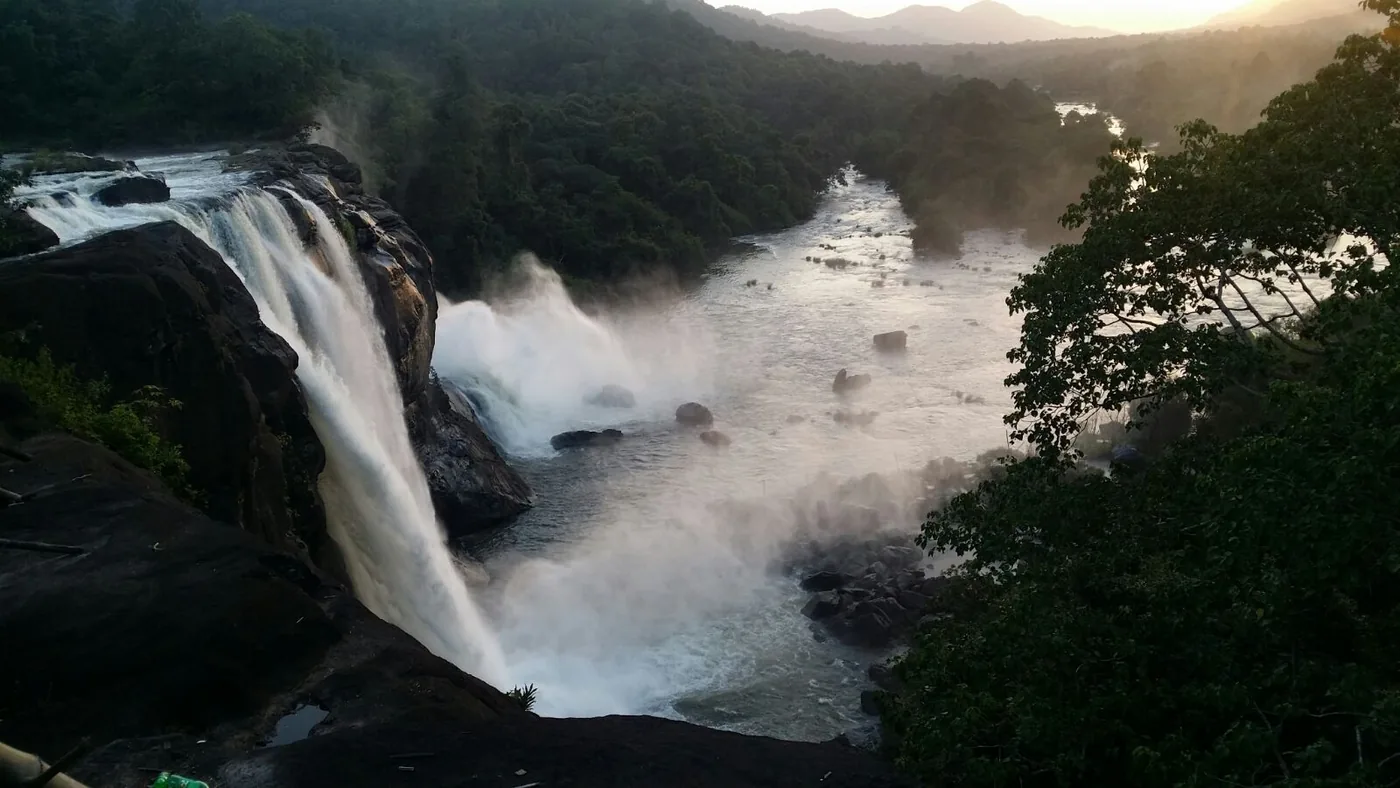
Wide view of Athirappilly Falls and the Chalakudy River at sunset
Athirappilly Falls flowing through the forested Western Ghats landscape Photo: Milan S Thottathil. CC BY-SA 4.0; resized and converted to WebP. https://creativecommons.org/licenses/by-sa/4.0/

Places nearby

Places to visit around Athirappilly

Use the verified destination notes and nearby place guides to plan a practical route.

Planning notes for places near Athirappilly

Athirappilly upper viewpoint

The main visitor area looks across the broad river and the top of the waterfall. It is the easiest place to appreciate the width of the cascade, but barriers must be respected because the rocks and current are dangerous.

Athirappilly lower viewpoint

A stepped forest path descends towards the base-side viewpoint. It can be steep, wet and tiring, and access may be restricted during severe weather or unsafe river conditions. Allow time for the climb back.

Vazhachal Falls

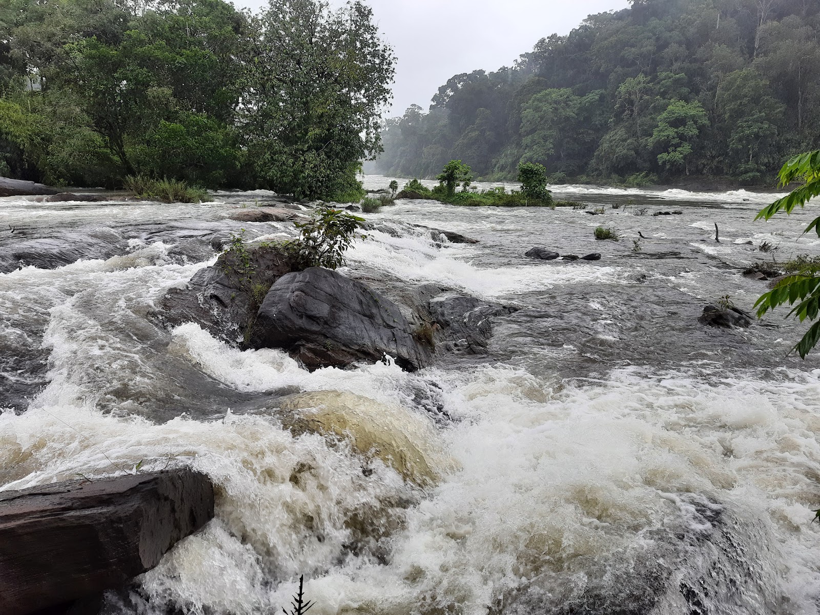
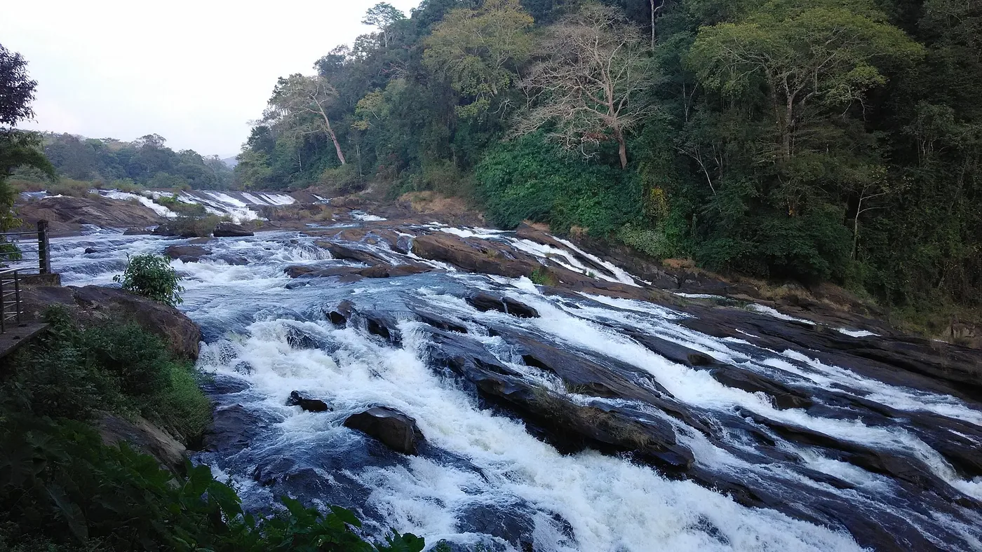
About 5 km from Athirappilly, Vazhachal is a fast-flowing series of rapids across a sloping rock bed on the Chalakudy River. View it only from the designated visitor area; the rocks and current are extremely hazardous.

Charpa Falls

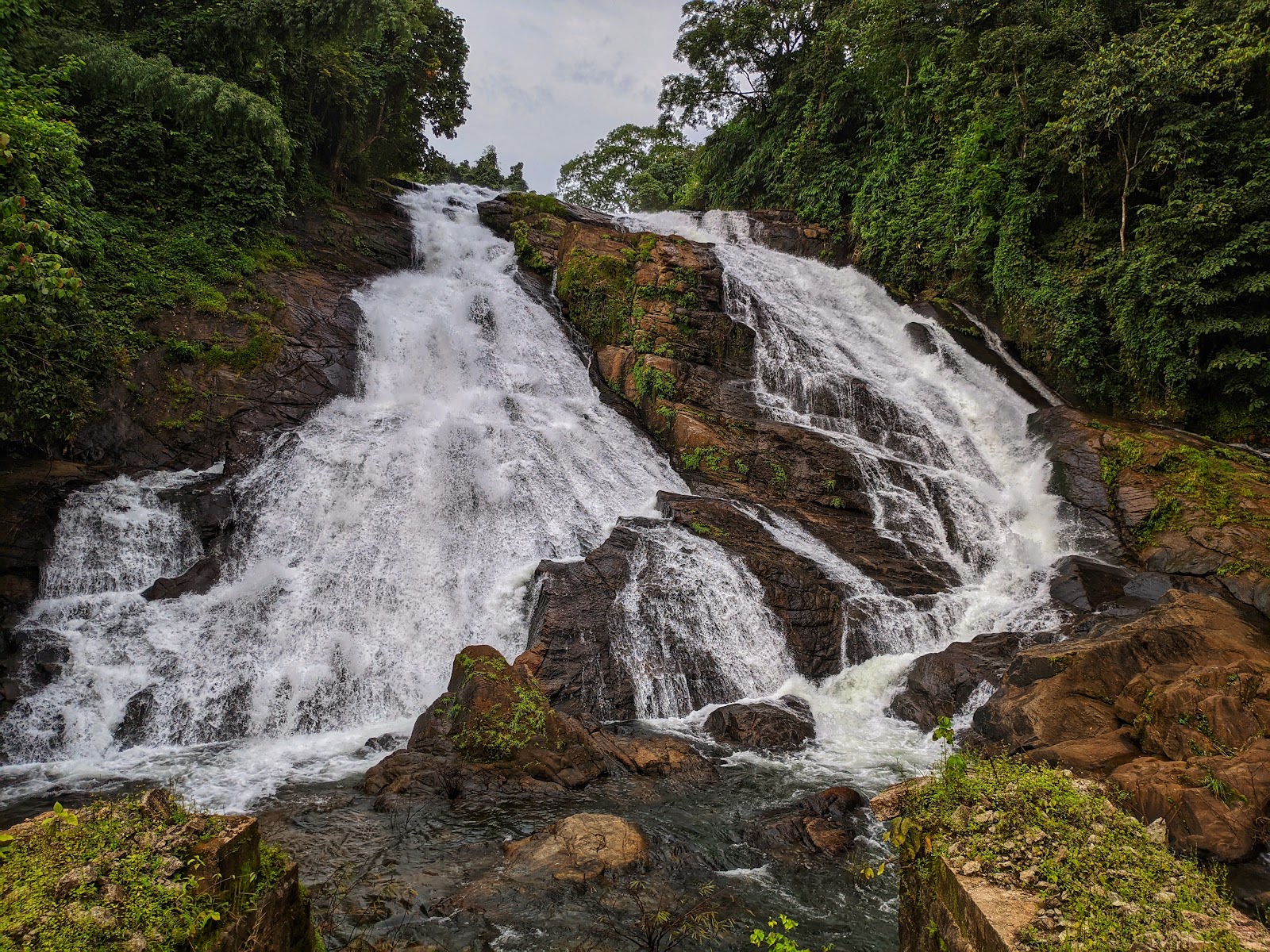
Charpa is a seasonal roadside cascade between Athirappilly and Vazhachal. It is most noticeable during the rains. Stop only where parking is permitted and never stand on the road for photographs.

Thumboormuzhi

Thumboormuzhi is a riverside stop on the Chalakudy approach, known for garden spaces and river scenery. Check its current facilities and opening arrangements before adding it to the route.

Sholayar forest road

The road beyond Vazhachal offers dense forest and reservoir-country scenery, but check-post hours, vehicle rules and closures can change. Do not rely on this extension without confirming access and return timing.

Things to do

Things to do in Athirappilly

Upper viewpoint

View the waterfall from the upper area before deciding whether the lower trail suits your group.

Lower viewpoint walk

Walk to the lower viewpoint when the route is officially open and conditions are safe.

Vazhachal Falls

Visit Vazhachal and compare its rushing rapids with Athirappilly’s vertical drop.

Seasonal Charpa Falls

Pause at seasonal Charpa Falls without blocking the narrow road.

Landscape photography

Photograph the forested river landscape while keeping people, barriers and wildlife undisturbed.

Birdwatching

Look and listen for hornbills and other forest birds; use binoculars and keep noise low.

Chalakudy-route stops

Break the journey at Thumboormuzhi or another verified stop on the Chalakudy route.

Stay overnight

Stay nearby for a quieter morning rather than compressing the area into a rushed drive from Kochi.

Best time to visit

Best time to visit Athirappilly

June to October — strong flow

Athirappilly is a year-round waterfall, but the experience changes with rainfall. June to October commonly brings the strongest flow, greener forest and heavy spray. It is visually dramatic, but intense rain can make paths slippery, reduce visibility and lead to temporary access restrictions. Never cross barriers or approach the river for a closer photograph.

November to February — comfortable sightseeing

November to February is often the most comfortable period for walking and combining Athirappilly with Vazhachal. The weather is usually milder and the lower trail may be easier than during peak rain, although flow varies from year to year.

March to May — warmer days

March to May is hotter and the cascade can be less forceful, but early visits may be quieter.

A simple plan

A simple Athirappilly day plan

Early start

Leave Chalakudy or your nearby stay early enough to reach Athirappilly near opening time. Check the weather, waterfall access and any forest-road restrictions before setting out.

Morning at Athirappilly

Begin at the upper viewpoint. If the official lower path is open and everyone is comfortable with a steep return climb, continue to the lower viewpoint. Move slowly on wet steps and allow at least 90 minutes for an unhurried visit.

Late morning at Vazhachal

Drive towards Vazhachal, stopping at Charpa only when there is a safe, permitted place to pull over. At Vazhachal, remain in the designated viewing area and stay away from the sloping river rocks.

Lunch and afternoon

Return towards Athirappilly or Chalakudy for lunch. Add Thumboormuzhi if its current opening hours suit the day, or spend a slower afternoon at your stay instead of forcing a long forest-road circuit.

Return before dark

Leave the forest approach with ample daylight. If continuing beyond Vazhachal towards Sholayar, confirm check-post requirements and the permitted return window before committing to the route.

Vazhachal Falls flowing over dark rocks beside dense forest
Vazhachal Falls rushing across the rock bed of the Chalakudy River Photo: Navaneeth Krishnan S. CC BY-SA 3.0; resized and converted to WebP. https://creativecommons.org/licenses/by-sa/3.0/

How to reach

How to reach Athirappilly

By road

From Chalakudy, follow the Athirappilly road through Kanjirappilly and the river-side forest approach. The district administration lists Athirappilly about 32 km from Chalakudy, 59 km from Thrissur and 73 km from Kochi. Start with enough daylight if you plan to continue towards Vazhachal or Sholayar because forest check-post and return-time rules may apply.

By bus

Public and private buses operate from Chalakudy towards Athirappilly, but frequency and the last return service can vary. Confirm the current timetable at Chalakudy before depending on a same-day return, particularly on Sundays, holidays or during weather disruptions.

By train

Chalakudy railway station is the nearest railhead, about 30 km away according to the Thrissur district administration. Continue by a confirmed bus, taxi or hired vehicle. Thrissur and Ernakulam Junction are larger alternatives farther away.

By air

Cochin International Airport is the nearest airport. Official tourism references quote different road distances—roughly 41 to 55 km—so allow time for traffic and route variation. A pre-arranged road transfer is the simplest onward option.

Open Athirappilly in Google Maps

Plan well

Practical information for Athirappilly

Check current access

Verify opening hours, last entry, entry charges, lower-trail status and weather warnings before leaving.

Plan for spray and rain

Carry a light rain layer and protect phones and cameras. Umbrellas can be awkward on crowded, windy steps.

Wear proper footwear

Choose shoes with reliable grip; stone steps and forest paths may remain wet even after rain stops.

Allow for crowds

Weekends, holidays and peak monsoon days can bring queues and slow traffic. Early arrival is more comfortable.

Carry water

Use refillable bottles and take all waste away. Food choices are wider towards Chalakudy and around established stay areas.

Expect a physical trail

The lower viewpoint requires a descent and return climb. Older visitors, small children and people with limited mobility may prefer the upper area.

Keep cash available

Ticketing, parking or small local services may not always accept digital payments. Do not rely on an old online fee list.

Respect the forest

Do not feed wildlife, play loud music, pick plants or leave marked visitor areas.

Confirm transport

If using buses, check the last return service rather than assuming frequent evening connections.

Safety first

Safety notes

River safety

Athirappilly and Vazhachal are powerful river environments, not swimming spots. Never enter the water or climb onto wet rocks.

Barriers and staff advice

Stay behind every barrier and follow forest and tourism staff instructions. Water levels and release conditions can change quickly.

Lower-trail access

Do not attempt the lower path during closure, severe rain, lightning or when anyone in the group is uncomfortable with steep wet steps.

Children at viewpoints

Supervise children continuously near viewpoints, steps, parking areas and the river.

Spray and slippery surfaces

Monsoon spray can reduce visibility and make surfaces slippery. Keep both hands available on difficult sections and secure loose belongings.

Safe parking

Do not stop vehicles at bends, bridges or narrow shoulders for photographs. Use only marked or locally directed parking.

Wildlife

Watch wildlife from a distance. Never feed monkeys or other animals, and keep food packed away.

Forest-road planning

Start any drive beyond Vazhachal with enough fuel, daylight and confirmed check-post access; mobile coverage may be inconsistent.

Emergency help

For urgent police, fire or medical help in Kerala, call 112.

Useful answers

Athirappilly travel FAQs

What is Athirappilly famous for?

Athirappilly is famous for Kerala’s largest waterfall, an approximately 80-foot cascade on the Chalakudy River surrounded by the Sholayar forest landscape.

Which is the best month to visit Athirappilly Falls?

There is no single best month for everyone. June to October usually offers stronger monsoon flow, while November to February is often more comfortable for walking and sightseeing. Check current rain and access conditions before travelling.

Can I visit Athirappilly and Vazhachal together?

Yes. Vazhachal is about 5 km from Athirappilly and is the most natural second stop. Confirm the current ticket, access and closing arrangements for both areas.

How far is Athirappilly from Chalakudy?

The Thrissur district administration lists Athirappilly about 32 km by road from Chalakudy. Chalakudy railway station is about 30 km from the waterfall.

How far is Athirappilly from Kochi?

The district administration lists a road distance of about 73 km from Kochi. Travel time varies considerably with traffic, weather and the exact starting point.

Is there a walk to the bottom of Athirappilly Falls?

A steep forest path normally leads towards a lower viewpoint, but it may close when conditions are unsafe. The return climb is demanding, so use it only when officially open and suitable for your group.

Can visitors swim at Athirappilly or Vazhachal?

No. The current, depth and slippery rocks are dangerous. Stay in designated visitor areas and follow all barriers and staff directions.

Are buses available to Athirappilly?

Buses operate from Chalakudy towards Athirappilly, but schedules and the final return service can change. Confirm the current timetable before relying on public transport.

Is Athirappilly suitable for children and older visitors?

The upper viewing area may suit many families, but wet surfaces, crowds and steps require care. The lower trail is steeper and may not suit young children, older visitors or people with limited mobility.

Should I stay overnight near Athirappilly?

An overnight stay is useful if you want an early, less rushed visit or plan to include Vazhachal and nearby forest scenery without a long same-day return to Kochi.

Stay near Athirappilly

Find a nearby stay

Spend less time travelling and keep more time for the destination.

View all nearby stays