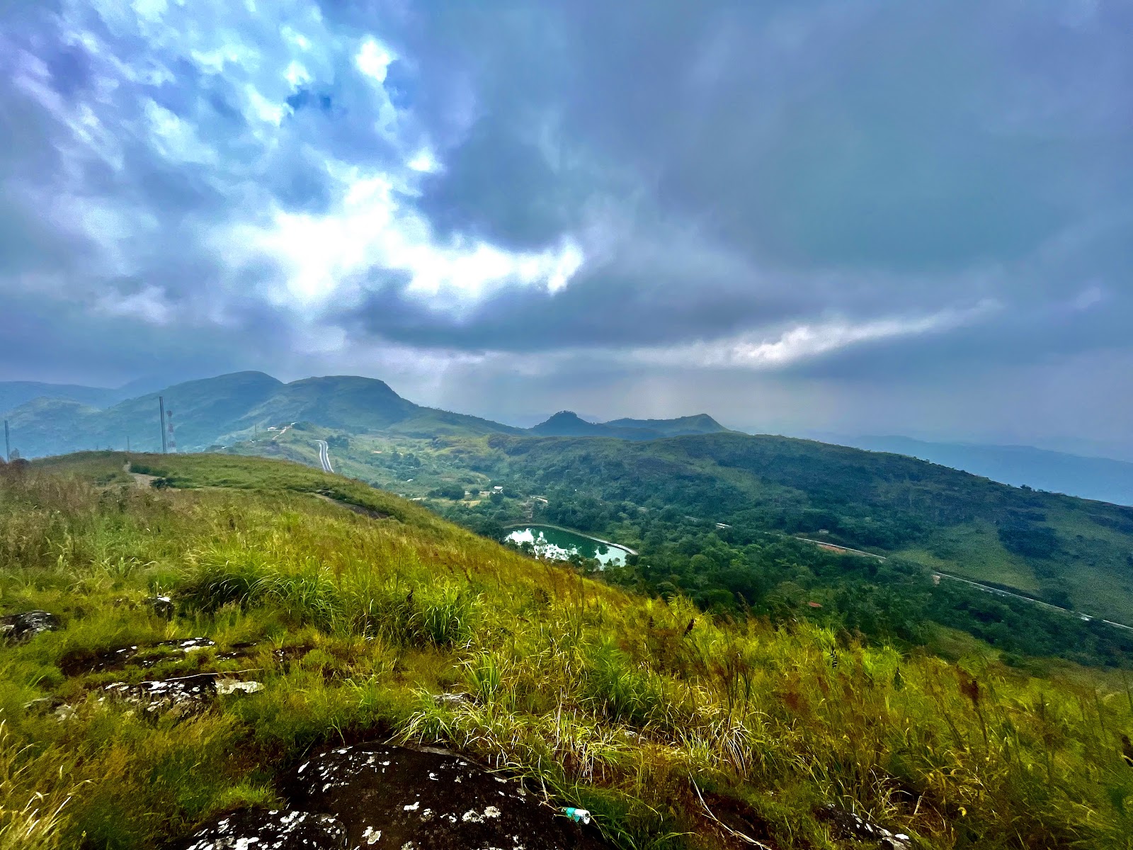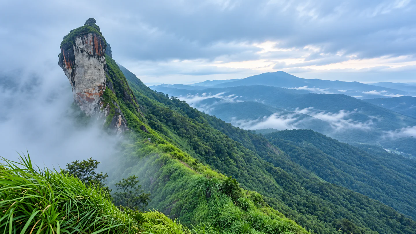
Illikkal Kallu monolith rising through mist above the Kottayam highlands

Kottayam · Kerala destination

Illikkal Kallu

Plan a weather-aware visit to Illikkal Kallu for its dramatic rock formation, misty ridges and wide Western Ghats views. Confirm current access before travelling, use only the permitted viewpoint route and turn back when rain, wind or poor visibility makes the exposed hill unsafe.

Illikkal Kallu monolith rising through mist above the Kottayam highlands — AI-assisted editorial reconstruction from a user-supplied reference

MountainsViewpointNature

Discover Illikkal Kallu

A weather-shaped landmark in the Western Ghats

Illikkal Kallu rises above the eastern Kottayam highlands as part of a three-hill formation associated with the names Kuda Kallu, Koonu Kallu and Illikkal Kallu. The official accounts describe a massive weathered rock, deep valleys, mountain streams and far-reaching views when cloud cover lifts.

The destination is not a casual roadside photo stop. The approach climbs through steep hill country, and the final visitor route can involve steps, sloping ground and exposed weather. Mist may create atmosphere but can also remove the view and reduce safe visibility within minutes.

Treat the public viewpoint as the destination. Do not attempt to reach the monolith itself, cross barriers or follow informal cliff-edge routes. A successful visit is one that matches the weather, daylight and ability of the group.
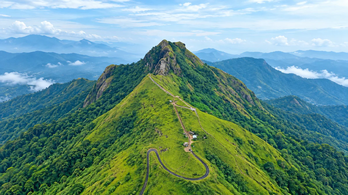
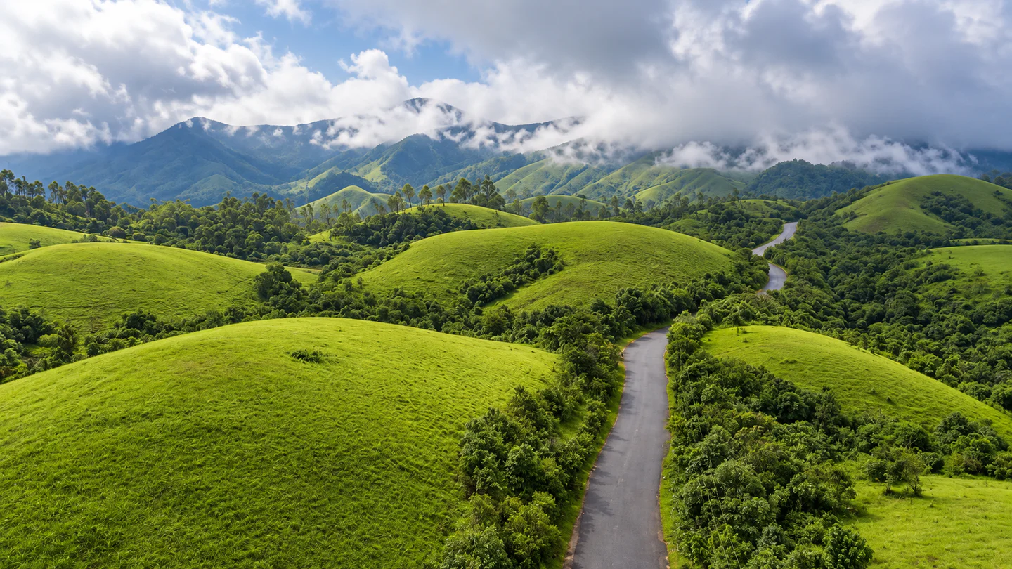
Aerial view of the green ridge and winding approach to Illikkal Kallu
Aerial view of the green ridge and winding approach to Illikkal Kallu — AI-assisted editorial reconstruction from a user-supplied reference

Why Illikkal Kallu

One rock, many mountain moods

The monolith

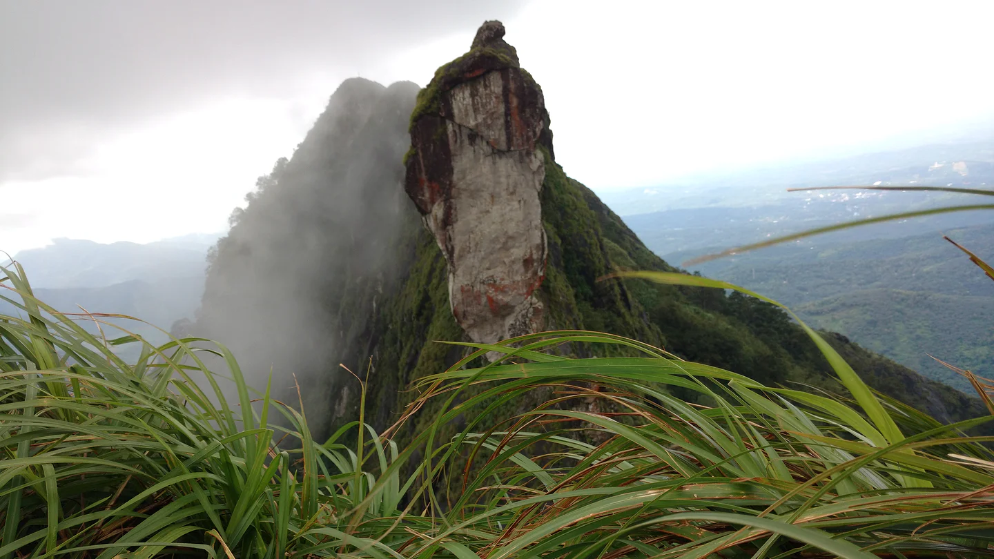
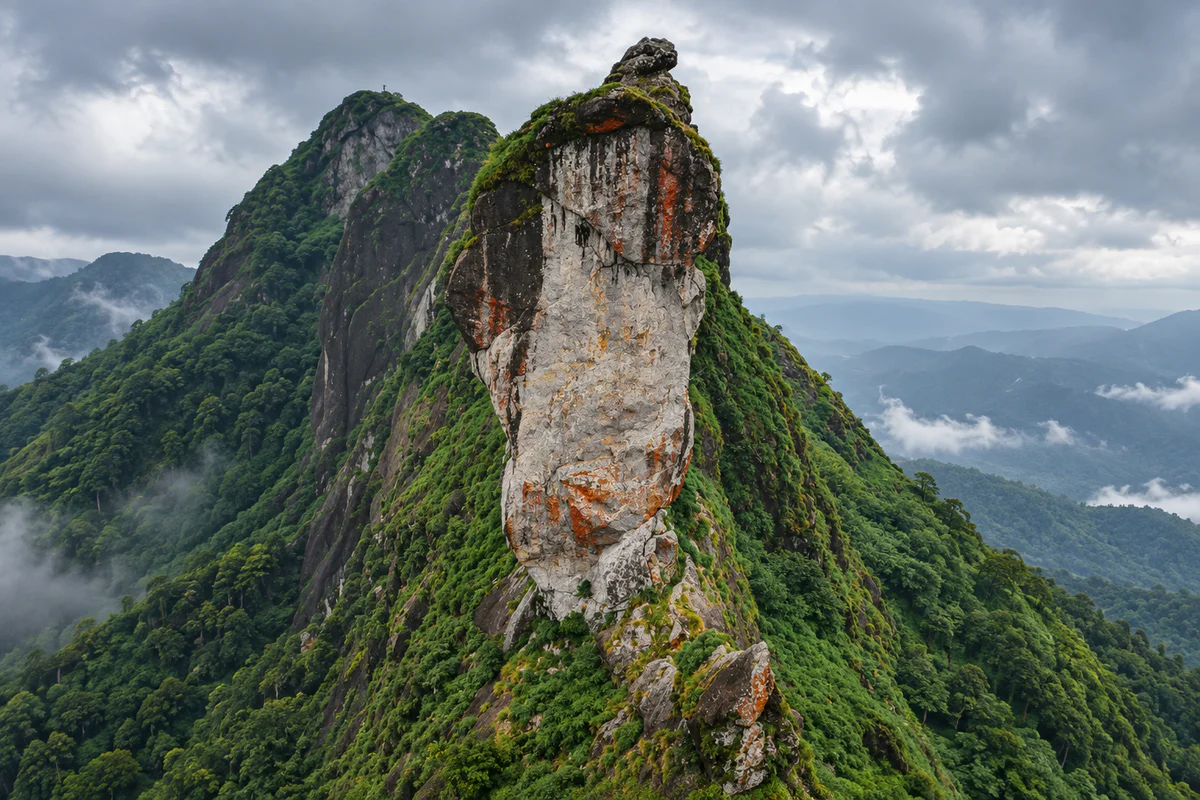
The near-vertical rock face gives Illikkal Kallu a recognisable silhouette unlike the softer surrounding ridges. View it from the permitted visitor areas rather than trying to approach the exposed formation.

Layered valley views

On a clear day, the viewpoint opens across green ridges and distant highlands. Clouds and mist can transform the scene quickly, so arrive with patience rather than expecting a guaranteed panorama.

A memorable hill-road journey

The winding approach is part of the experience, but it demands a careful driver and extra time. Stop only at authorised or clearly safe locations.

A compact highland itinerary

Illikkal Kallu can anchor a half-day outing, with one nearby waterfall or hill destination added only when weather, road conditions and daylight allow.

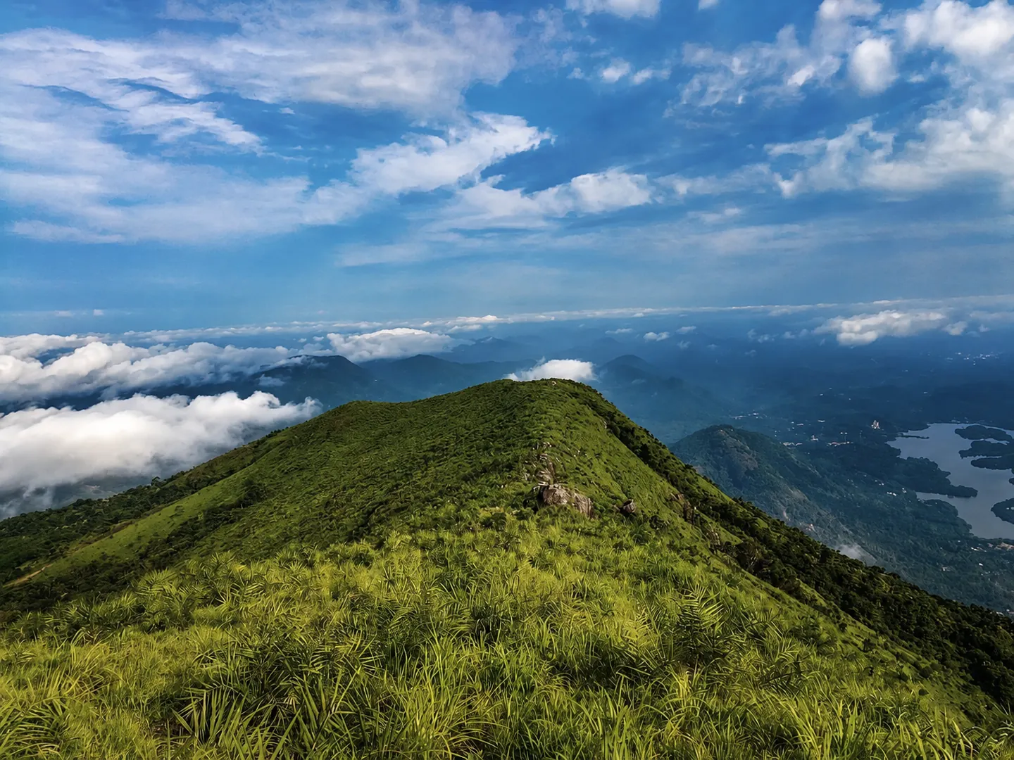
Close landscape view of the weathered Illikkal Kallu rock formation
Close landscape view of the weathered Illikkal Kallu rock formation — AI-assisted editorial reconstruction from a user-supplied reference

Places nearby

Places to visit near Illikkal Kallu

Use the verified destination notes and nearby place guides to plan a practical route.

Illikkal Kallu framed by mountain grass and drifting mist
Illikkal Kallu framed by mountain grass and drifting mist — user-supplied corrected photograph

Planning notes for places near Illikkal Kallu

Illikkal Kallu viewpoint

Use the managed visitor route and viewing areas for the primary experience. Barriers and restrictions exist for safety; never interpret a visible path as permission to proceed.

Kattikkayam Waterfalls

This nearby waterfall involves a separate approach and potentially slippery terrain. DTPC advises care around unpredictable water and rocks, so add it only in suitable weather and daylight.

Ilaveezhapoonchira

A separate hill destination with open views and its own road and access conditions. Combining both hills can become rushed when mist, rain or slow roads intervene.

Marmala Waterfalls

A longer extension for travellers already staying in the highlands. Confirm the final route, local access and water conditions before committing to the walk.

Nearby cards use published Hopnest place records within the wider area. Distances are straight-line references, not driving times.

Things to do

Let the weather set the pace

Walk to the permitted viewpoint

Take the formal path slowly, use handrails where available and allow descending visitors room to pass. Wet steps and strong crosswinds can change the difficulty.

Watch the mist move through the valley

Cloud breaks can reveal the landscape for only a few minutes. Enjoy the changing atmosphere without moving beyond railings for an unobstructed photograph.

Photograph the rock responsibly

A moderate or wide lens can keep both the monolith and surrounding ridges in context. Keep bags, tripods and groups clear of the walking route.

Pair the hill with one nearby stop

Choose only one additional attraction after checking road time and conditions. A slower plan is safer and usually produces a better highland visit.

Best time to visit

Choose visibility and safe footing over a fixed season

Clear post-monsoon and winter days

Cooler months can offer comfortable walking and layered views, but local rain and mist remain possible. Check the same-day forecast rather than relying only on the season.

Summer mornings

Earlier hours can reduce heat and leave more time for the return journey. Carry water and sun protection even when the summit looks cloudy.

Rainy or stormy periods

Official tourism material warns that hill paths can become slippery during rain. Postpone the visit during heavy rain, lightning, strong wind, landslip warnings or very poor visibility.

Late afternoon

Sunset can be attractive, but do not let photographs delay the descent. Respect the current closing time and leave enough daylight for the hill road.

A simple plan

A practical half-day hill plan

Morning — Check before departure

Confirm the official opening status, weather, road condition and any parking or transfer arrangement. Save the destination pin and accommodation contact offline.

Late morning — Approach the hill carefully

Allow extra time for bends, local traffic and narrow sections. Use the designated parking or drop-off point rather than stopping on the road.

Midday — Walk to the viewpoint

Climb at the pace of the slowest person. Pause at safe areas, remain behind barriers and reassess if rain, wind or mist intensifies.

Early afternoon — Return and take a break

Descend before fatigue or wet weather makes the path harder. Have food or refreshments only at a verified outlet or your accommodation.

Later afternoon — Optional nearby stop

Add Kattikkayam, Ilaveezhapoonchira or another published place only when the route, access and remaining daylight are suitable. This is a flexible sequence, not a timed tour.

How to reach

Plan the mountain road and final approach separately

By road

Erattupetta is the nearest major road reference in official tourism guidance, roughly 19–20 km away. Use navigation to the managed visitor area, then follow current local parking and transfer instructions.

By train

Kottayam railway station is the principal rail reference, approximately 55–57 km away in official sources. The onward hill-road journey can take considerably longer than the distance suggests.

By air

Cochin International Airport is the nearest major airport reference, approximately 85 km away. Arrange a driver comfortable with steep and winding roads.

Final ascent

DTPC describes a short jeep drive from the base or a hike up the approach. Availability and rules can change, so confirm locally and do not assume a vehicle will operate on every visit.

Open Illikkal Kallu in Google Maps

Plan well

Prepare for a simple but exposed hill visit

Verify current arrangements

Official pages do not fully agree on fee details, and operational arrangements can change. Check the DTPC destination page or contact the site manager before travelling.

Wear suitable footwear

Choose shoes with reliable grip. Avoid smooth sandals on wet steps or loose hill surfaces.

Carry light essentials

Bring water, rain protection, sun protection and personal medication, but keep both hands available on steeper sections.

Accessibility

The uphill route, steps and exposed terrain may not suit every visitor. Ask the site manager about current vehicle access, walking distance, toilets, seating and handrails before taking children, older adults or visitors with limited mobility.

Keep the hill clean

Carry all waste back, avoid loud music and do not damage plants or rock surfaces. Drones require the relevant permissions and must not endanger visitors or wildlife.

Safety first

The viewpoint is spectacular because it is exposed

Stay behind barriers

Do not climb railings, approach cliff edges, enter closed zones or attempt historic informal routes associated with the rock formation.

Stop for bad weather

Rain, lightning, strong wind and sudden mist can make the path unsafe. Follow staff instructions immediately and leave when asked.

Protect your footing

Walk rather than run, keep children within reach and avoid crowding narrow steps. Wet grass and stone can remain slippery after rain stops.

Drive defensively

Use a roadworthy vehicle, avoid overtaking on blind bends and do not park where you narrow the carriageway. Night driving adds difficulty on an unfamiliar hill road.

Emergency planning

Keep phones charged, share the route with your accommodation or driver and save local contacts offline. For an emergency, seek site staff assistance and contact the appropriate emergency service.

Useful answers

Questions about visiting Illikkal Kallu

What is Illikkal Kallu known for?

It is known for a dramatic monolith, unusual weathered hill shapes, mist and panoramic views across the Kottayam highlands.

How much time should I allow?

Allow at least half a day including the winding road approach, viewpoint walk and time for changing visibility.

Can visitors climb the monolith?

No. Plan around the permitted public viewpoint and obey all barriers, closures and staff instructions.

Is there an entry fee?

DTPC currently lists adult and child fees, while another official publication gives different fee information. Verify the current amount directly before travel.

What are the opening hours?

DTPC currently lists 8:00 AM to 6:00 PM on all days. Operational hours can change because of weather or management decisions.

Is it suitable during rain?

Rain can make the route slippery and reduce visibility, while lightning and wind increase exposure. Postpone the trip in unsafe conditions or during official alerts.

Is the viewpoint suitable for young children or older adults?

That depends on current access, walking ability and weather. Ask about the uphill distance, steps, vehicle transfer and facilities before setting out.

What else can I visit nearby?

Kattikkayam Waterfalls and Ilaveezhapoonchira are useful options, but each has separate access and safety considerations. Add only one if conditions and daylight permit.

Are nearby distances driving distances?

No. Hopnest nearby listings are ordered using straight-line coordinates. Winding roads can make actual travel much longer.

Stay near Illikkal Kallu

Find a nearby stay

Spend less time travelling and keep more time for the destination.

View all nearby stays