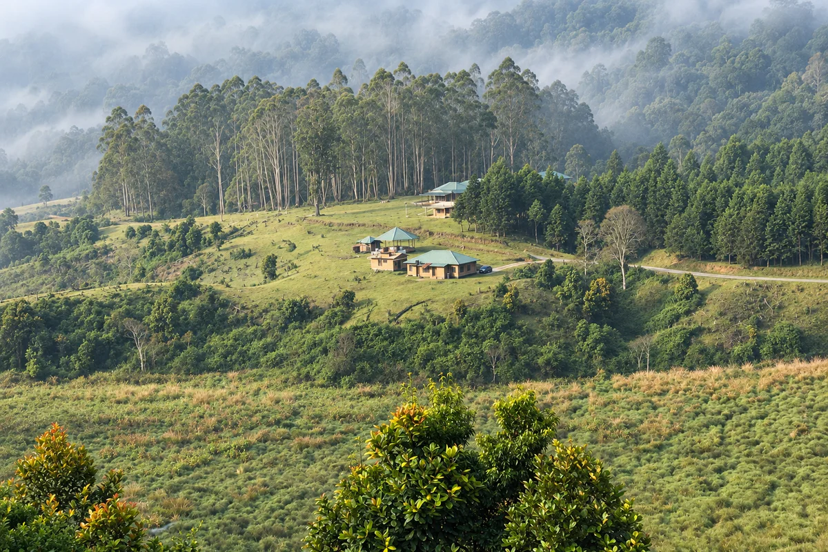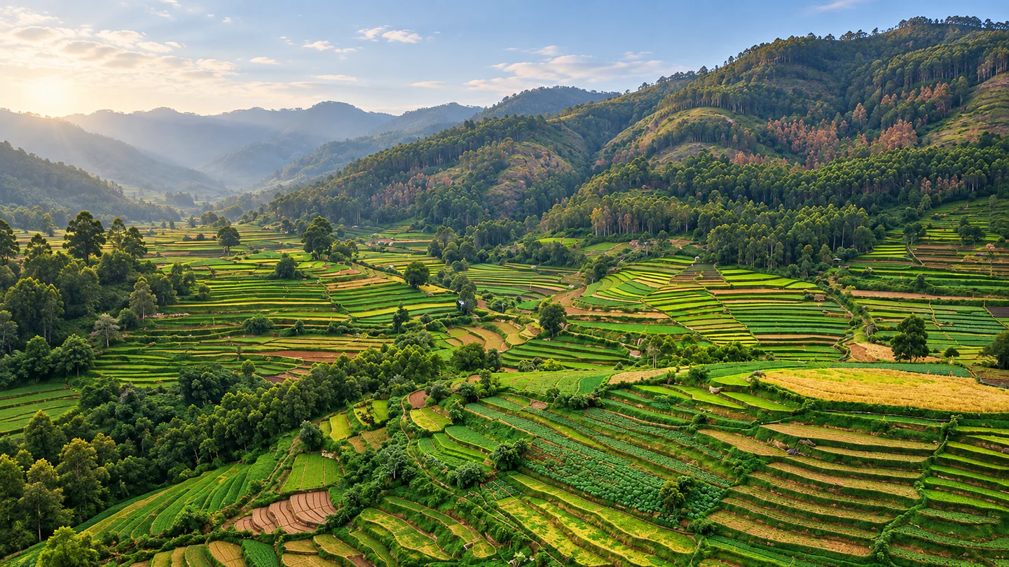
Terraced vegetable farms across the highland slopes of Vattavada

Idukki · Kerala destination

Vattavada

Travel beyond Top Station into Vattavada's cool highland landscape, where terraced vegetable fields, orchards, village roads and protected shola forests shape a quieter side of Idukki.

Terraced vegetable farms across the highland slopes of Vattavada — AI-assisted editorial reconstruction from a user-supplied reference

Highland VillageFarm CountryNature

Discover Vattavada

A highland farming village at the forest edge

Vattavada lies east of Munnar in Idukki district, close to Kerala's border with Tamil Nadu. Kerala Tourism describes a high-altitude village of terraced slopes, vegetable farms, orchards and forest patches, reached by a scenic road through Mattupetty, Kundala and Top Station. The journey is part of the experience, but the distance and winding road make Vattavada better as an overnight destination than a hurried Munnar add-on.

Agriculture gives the village its identity. Cool-climate vegetables, garlic and strawberries grow across a patchwork of small holdings. Farms are working livelihoods rather than open attractions, so meaningful visits depend on permission, a host or an organised farm experience. Buy produce where invited, avoid walking through planted rows and ask before photographing residents.

Protected landscapes surround the village. Pampadum Shola National Park lies on the approach, while Anamudi Shola and Kurinjimala form part of the wider conservation setting. Trekking, forest stays and trail access are controlled activities whose availability can change with weather, wildlife movement and Forest Department decisions. A strong Vattavada plan remains rewarding even when a forest programme is unavailable.
Why Vattavada

See a different kind of Kerala hill country

Read the landscape through its farms

Terraced fields wrap around slopes and settlements, producing a changing mosaic of vegetables, garlic, fruit and fallow earth. View them from public roads and designated viewpoints unless a farmer or host welcomes you onto the land.

Slow down beyond Munnar's busiest circuit

Vattavada rewards an overnight stay, an early walk and time to watch mist move across the hills. The atmosphere is rural and lived-in rather than arranged as a single attraction.

Pair village scenery with shola ecology

Pampadum Shola protects compact but biologically rich montane forest and grassland. Join only authorised programmes and let current forest guidance determine the route, timing and group size.

Follow the Top Station road to its quieter end

The approach passes reservoir, plantation and border-country scenery before reaching Vattavada. Build generous stops into the journey without blocking traffic or entering private estates.

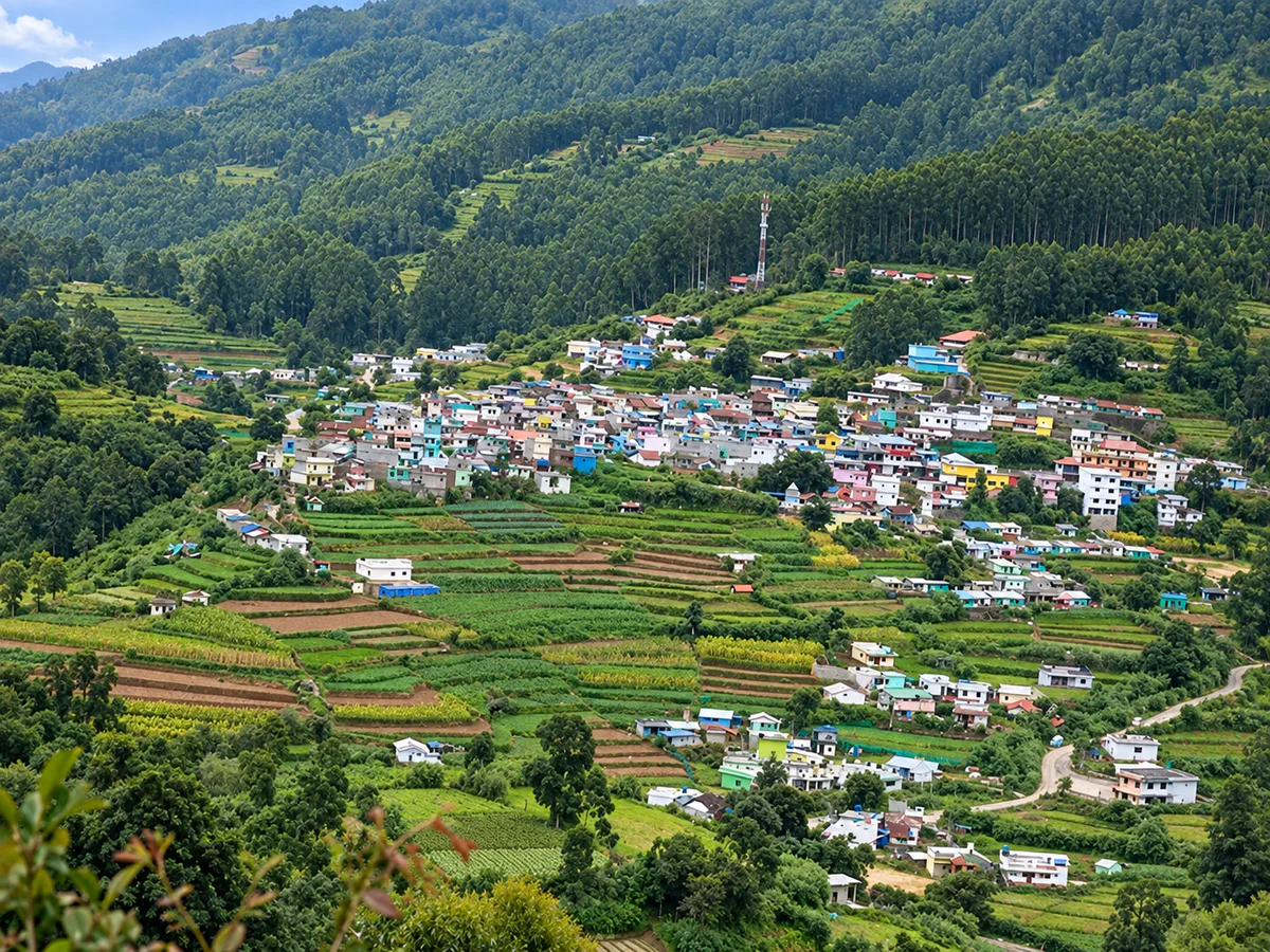
Vattavada village surrounded by terraced farms and forested hills
Vattavada village surrounded by terraced farms and forested hills — AI-assisted editorial reconstruction from a user-supplied reference

Places nearby

Places to visit in and around Vattavada

Use the verified destination notes and nearby place guides to plan a practical route.

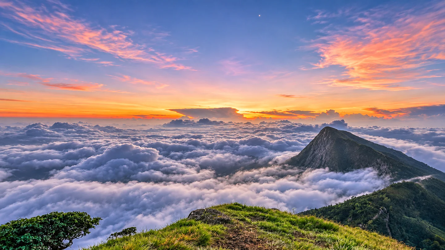
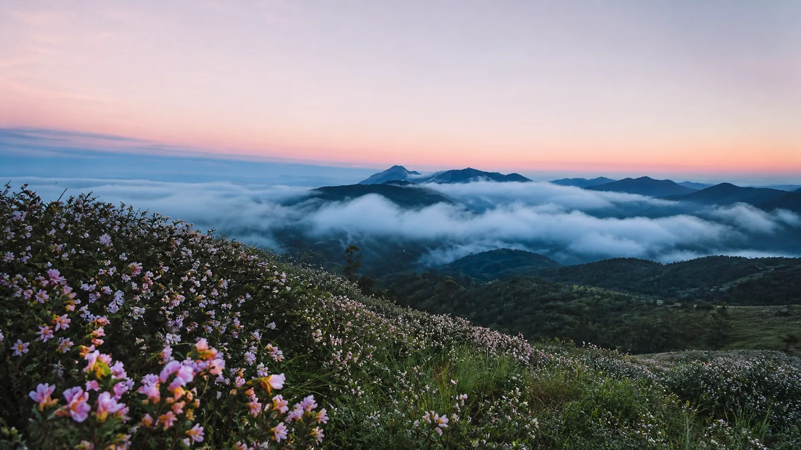
Misty grassland and forest-edge scenery near the Vattavada route
Misty grassland and forest-edge scenery near the Vattavada route — AI-assisted editorial reconstruction from a user-supplied reference

Planning notes for places near Vattavada

Vattavada village and farm viewpoints

Begin with the village's public roads and signed viewpoints for broad views over terraced fields. Keep vehicles clear of narrow lanes and avoid stepping into crops for photographs.

Pazhathottam

This nearby farming area opens onto layered hill and valley views. Visit in a cool, clear window, support local produce sellers where appropriate and confirm the exact access route with your stay or driver.

Pampadum Shola National Park

Kerala's smallest national park protects dense shola forest, grassland and wildlife habitat on the Munnar–Vattavada route. Entry, trekking and accommodation are controlled; contact the Forest Department and reconfirm the current programme before travelling.

Top Station

Top Station is the best-known viewpoint on the approach from Munnar, with expansive views toward Tamil Nadu when cloud lifts. Arrive early, use designated parking and allow for crowds and mist.

Strawberry and vegetable farms

A hosted farm visit can add local context to the scenery and may include seasonal produce or farm-made products. Availability changes with the crop cycle, and entry should always be by invitation or through an identified operator.

Anamudi Shola and Kurinjimala landscape

These protected areas form part of Vattavada's wider ecological setting, but they are not unrestricted sightseeing grounds. Treat access as permission-based and follow current Forest Department instructions.

Things to do

Let farms, forest and village roads shape the day

Take a slow village walk

Choose public lanes with light traffic and walk during a clear morning or late afternoon. Give farm vehicles priority, keep voices low near homes and carry every piece of waste back with you.

Join a hosted farm experience

Learn how cool-climate crops are grown and buy local produce directly when invited. Ask what is in season rather than expecting strawberries or a particular harvest throughout the year.

Book an authorised shola trek

Kerala Tourism lists a guided trek between Pampadum Shola and Vattavada. Availability, timing and route can change, so reserve through the authorised eco-tourism or Forest Department channel and accept closures.

Photograph the terraced landscape responsibly

Use established viewpoints and road pull-offs. A longer lens often creates a better composition than entering a field, flying an unauthorised drone or photographing residents without consent.

Choose a locally operated jeep outing carefully

A jeep can reach rougher village roads and viewpoints, but routes vary. Confirm the operator, vehicle condition, inclusions and land-access permission, and never pressure a driver to enter a closed or damaged track.

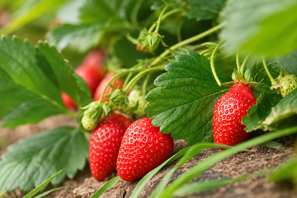
Ripe strawberries growing on a highland farm
Ripe strawberries growing on a highland farm — AI-assisted editorial reconstruction from a user-supplied reference

Best time to visit

Choose the season for visibility, crops or monsoon mood

October to February

Cooler days and clearer intervals generally suit village walks and broad hill views. Nights can feel cold, especially in exposed accommodation, so carry warm layers.

March to May

Days are brighter and can be warmer in open fields, while mornings remain useful for walking. Farm colour depends on the current crop cycle rather than a fixed tourism calendar.

June to September

Monsoon rain deepens the green landscape and feeds streams, but fog, slippery roads, leeches and forest restrictions can limit plans. Keep the itinerary flexible and follow current district and forest alerts.

Crop and fruit seasons

Garlic, vegetables and strawberries are working crops with planting and harvest cycles that vary. Ask farms and accommodation hosts what can genuinely be visited or purchased during your dates.

Time of day

Early morning often offers quieter roads and the best chance of clear views. Complete forest-edge walks and unfamiliar hill driving well before darkness.

A simple plan

A relaxed two-day Vattavada plan

Day 1 morning — Take the Top Station road slowly

Leave Munnar with time for safe, designated stops around the reservoir and Top Station corridor. Do not turn a scenic hill road into a race between viewpoints.

Day 1 afternoon — Meet the farming village

Check in, confirm local access with your host and explore Vattavada's public lanes and viewpoints. Add a hosted farm visit only when permission and the crop cycle make it appropriate.

Day 1 evening — Settle into the highland pace

Return before dark, buy local produce where available and use the evening to reconfirm the next morning's forest or jeep arrangement.

Day 2 morning — Choose forest or farm country

Join a pre-confirmed Pampadum Shola programme, or take a guided village and farm walk if forest access is unavailable. Follow the authorised route and the guide's wildlife instructions.

Day 2 afternoon — Pazhathottam and the return journey

Use a clear-weather window for Pazhathottam or another verified local viewpoint, then allow generous time for the winding return toward Munnar.

Alternative wet-weather plan

Stay close to the village and your accommodation, visit produce outlets that are safely accessible and postpone forest trails, waterfalls, rough jeep routes and exposed viewpoints.

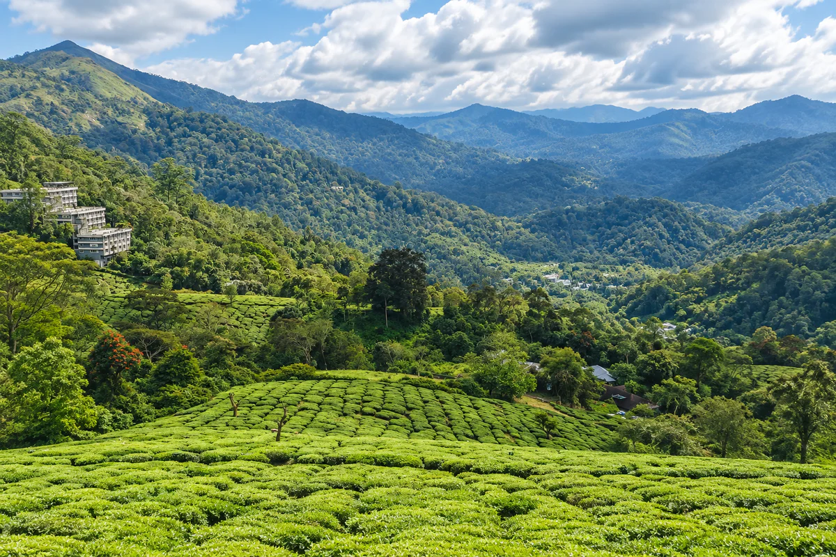
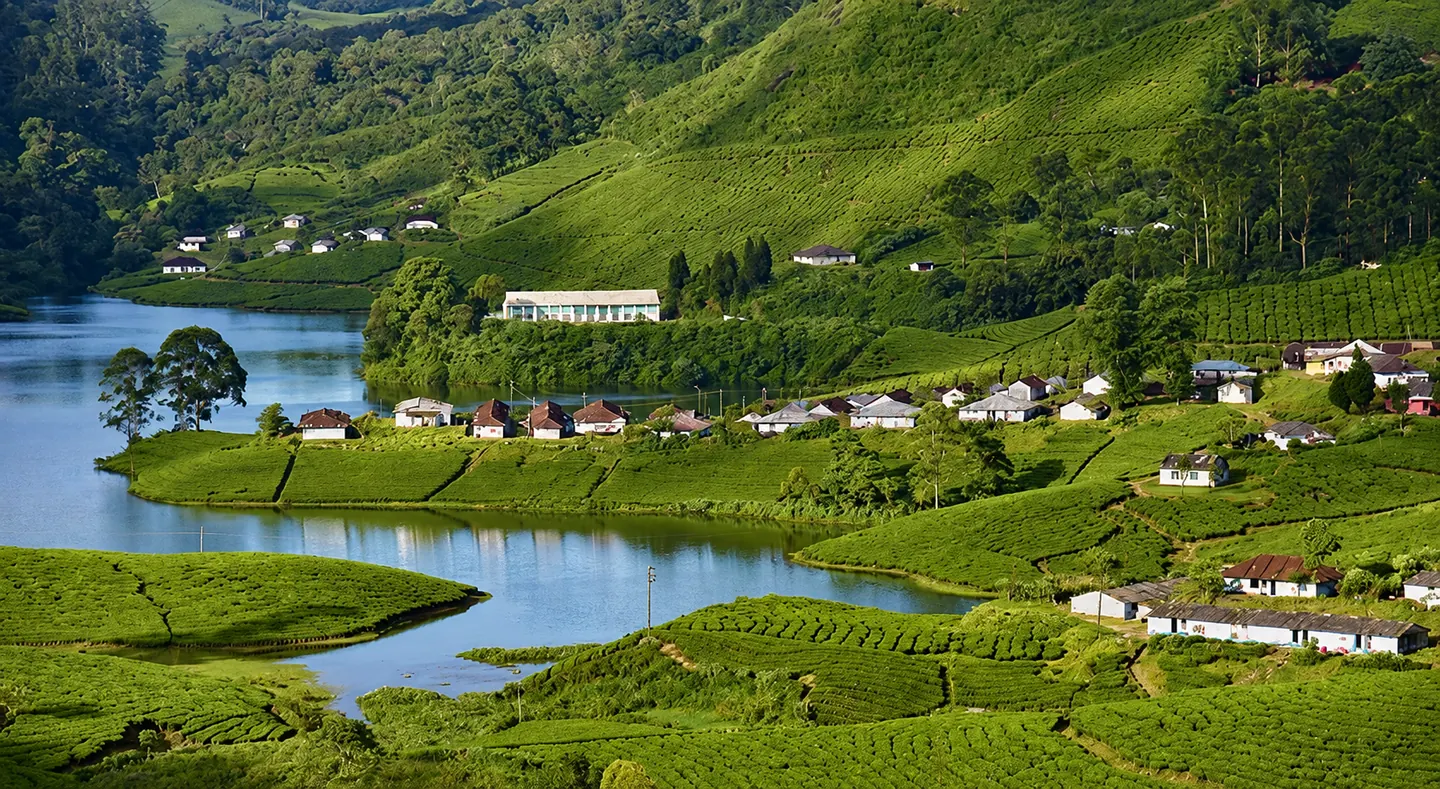
Tea gardens and forested hills on the wider Munnar approach
Tea gardens and forested hills on the wider Munnar approach — AI-assisted editorial reconstruction from a user-supplied reference

How to reach

Reach Vattavada through Munnar and Top Station

By road from Munnar

The usual route runs from Munnar through Mattupetty, Kundala and Top Station before continuing to Vattavada. Kerala Tourism places the village roughly 42–45 km from Munnar; winding roads and sightseeing traffic make travel time more useful than distance alone.

By train

Aluva and Ernakulam are the practical major rail connections for the Munnar region. Continue by road via Munnar using a bus, taxi or pre-arranged transfer.

By air

Cochin International Airport is the principal airport for this side of Idukki. The onward journey is long and entirely by road, so avoid pairing a tight flight connection with a same-day Vattavada departure.

By bus

Buses reach Munnar and local services may continue toward Vattavada, but frequencies and final timings can vary. Confirm the current service locally before depending on a late connection.

Getting around

A hired vehicle or locally arranged jeep makes scattered viewpoints and accommodation easier to reach. Confirm the final approach to your stay, because a Vattavada address can include a steep, narrow or unpaved section.

Open Vattavada in Google Maps

Plan well

Plan around a working village and protected landscape

Stay at least one night

The road from Munnar is scenic but slow. An overnight stay creates room for an early village walk and avoids compressing the destination into a rushed return trip.

Confirm farm access

Do not assume that every colourful field or strawberry plot welcomes visitors. Arrange visits through your host or an identified farm, ask before entering and purchase produce without bargaining aggressively.

Reconfirm forest programmes

Trek routes, forest stays, entry timings and fees can change with weather, wildlife and management decisions. Contact the official operator close to your visit and keep an equally satisfying village alternative.

Carry cash, layers and basic supplies

Digital payment and mobile coverage may be inconsistent. Pack warm and rain layers, drinking water, essential medicines, sun protection and footwear suited to wet soil.

Check the exact stay location

Review the map, access surface, parking and meal arrangements before booking. Late-night driving and searching for an isolated property are poor fits for unfamiliar highland roads.

Safety first

Use conservative choices on forest-edge roads and trails

Respect wildlife and forest closures

Elephants, gaur and other wildlife occur in the wider landscape. Never approach or feed animals, leave the vehicle only where permitted and follow Forest Department or local warnings immediately.

Do not stop on blind bends

The Top Station road is narrow and winding. Use proper pull-offs, keep the carriageway clear and avoid standing in the road for photographs.

Treat farm slopes and waterfalls cautiously

Wet soil, loose field edges and rocks can be slippery. Do not enter irrigation channels, climb unsupported terraces or approach waterfalls during heavy rain or strong flow.

Use authorised guides for forest routes

Do not follow an online trail into protected forest. Carry water, rain protection and any prescribed identification, and remain with the guide and group.

Monitor weather and road advice

Fog and intense rain reduce visibility and can affect roads. Use current district and state alerts, postpone unnecessary travel in severe conditions and finish unfamiliar routes before nightfall.

Useful answers

Questions about visiting Vattavada

What is Vattavada known for?

Vattavada is known for terraced vegetable farms, garlic, seasonal strawberries, cool highland scenery and its location beside protected shola landscapes.

Is Vattavada a village or a district?

Vattavada is a village and local-body area in Idukki district, Kerala, near the Tamil Nadu border.

How far is Vattavada from Munnar?

Kerala Tourism places it roughly 42–45 km from Munnar by the scenic Top Station route. Hill-road traffic and stops make journey time more important than the distance alone.

How many days are enough for Vattavada?

One overnight stay or two relaxed days suit the village, farm viewpoints and one confirmed forest or guided local experience.

Can I visit strawberry farms?

Some farms offer hosted visits or sell produce, but access and fruit availability are seasonal. Arrange the visit and ask permission rather than walking into a working field.

Can I trek from Pampadum Shola to Vattavada?

Kerala Tourism lists an authorised eco-tourism trek, but programmes are subject to current weather, forest conditions and management decisions. Confirm directly before travel.

Is Vattavada suitable during the monsoon?

The landscape is very green, but fog, rain, slippery roads and forest restrictions can disrupt plans. Travel only with a flexible itinerary and current weather guidance.

Do I need a private vehicle?

Public transport may be available, but a hired vehicle makes the long approach and scattered accommodation easier. Confirm current bus timings if you plan to travel without one.

Are nearby-card distances driving distances?

No. Hopnest nearby cards use straight-line coordinates, so the actual journey on mountain roads can be much longer.

Stay near Vattavada

Find a nearby stay

Spend less time travelling and keep more time for the destination.

View all nearby stays